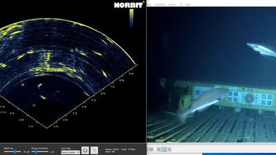
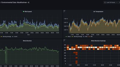
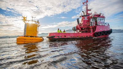
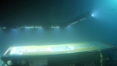
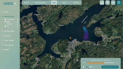
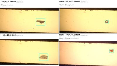
The Water Quality Digital Twin of the Ocean acquires in-situ data from stationary sensor platforms, including surface buoys and underwater (benthic) stations. Additionally, mobile sensor platforms (unmanned vehicles) collect on-demand data throughout the water column. The DTO continuously provides real-time or near real-time data on various water quality parameters, such as temperature, salinity, ocean currents, turbidity, and pollutants. It also occasionally integrates a seabed camera and sonar feed, particle camera images, and a novel microplastic sensor. This data can be processed using analytic tools and ocean transport models to assess current conditions, analyze historical trends, and predict future events. Near real-time raw or processed data is presented in the form of time-series graphs, 2D maps, or 3D visualizations.
Applications
Marine Environmental Monitoring & Compliance. The Marine Strategy Framework Directive (MSFD) requires EU Member States to establish monitoring programs to assess, achieve, and maintain Good Environmental Status, including tracking micro-litter (e.g., microplastics). The Water Quality DTO provides real-time or near real-time water quality data, supporting marine ecosystem assessments and regulatory compliance.Scientific Research & Technological Development. The DTO serves as a valuable platform for researchers and technology developers to simulate complex ocean processes, test hypotheses, and validate innovative solutions. It supports the entire data lifecycle—from in-situ data acquisition and management to analysis and visualization. Users can test novel sensors and technologies on the DTO’s surface or subsea stations or develop, train, and refine algorithms using DTO data. This accelerates advancements in marine biology, oceanography, climate science, data science, sensing technologies, and robotics.Industry & Public Sector Collaboration. The Water Quality DTO has attracted interest from various industrial and public stakeholders, including aquaculture, technology providers, port authorities, tourism agencies, local communities, and environmental organizations.Research & Industrial Partnerships. Could your project benefit from the DTO’s infrastructure and scientific expertise? Our research partners are open to collaborations for further development and application of the DTO in new or existing projects.Knowledge Transfer & DTO Replicability. Would a Water Quality DTO benefit your geographical area? Our team provides knowledge transfer services to help design and implement a tailored DTO that meets both customer-specific needs and regional requirements.
Associated products
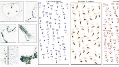
Microplastic Sensor was deployed and tested as part of the pilot’s surface observatory.GeoViz was used for predicting and analyzing the distribution of particles in the ocean. It processes output files (NetCDF) from particle transport models (e.g., OpenDrift) to visualize the evolution of particles in a four-dimensional space (3D spatial and size distribution).PyOPIA (Python Ocean Particle Image Analysis) was utilized in the pilot alongside SilCam, an in-situ particle imaging camera, for particle identification. Additionally, it was applied in the algae bloom case study for zooplankton classification.