Environment | Research
Sediment Transport Pilot: Gulf of Riga Near-Bottom Velocity and Wave Study
Overview
Coastal sediment transport significantly influences estuarine dynamics and the structural integrity of coastal constructions. Predicting sediment movement is essential for optimizing port structures, reducing maintenance costs, and improving coastal engineering solutions. This pilot project aimed to provide high-resolution in-situ measurement data to support sediment transport modeling and wave pattern analysis in the eastern Gulf of Riga.
Project Goals
The primary objective was to assess sediment transport probabilities and wave-driven hydrodynamic forces to enhance sediment modeling efforts. Understanding these processes helps in identifying erosion-prone areas, optimizing coastal infrastructure planning, and improving predictive modeling accuracy.
Data Collection and Methodology
The measurements were conducted in the Gulf of Riga, Baltic Sea, between 3. August 2022 and 5. September 2022. . Continuous velocity, direction and pressure measurements were taken using a 3x3 sensor grid with full dimensions 20m x 20m. Sensors were placed 10m apart.The study utilized:
- An array of nine high-resolution Hydromast devices to record pressure and near-bottom water velocity.
- An acoustic Doppler velocimeter (ADV) to measure three-component water velocity.
- Meteorological and bathymetric data to contextualize wave conditions.
The study area was selected to capture conditions typical of short-crested wind-driven waves, which strongly influence sediment movement. Data collection focused on measuring spatial and temporal variability in near-bottom velocities, which are crucial for understanding sediment entrainment and transport patterns.
Dataset includes continuous measurements of:
- Velocity [m/s], ±0.1m/s
- Direction [deg], ±10 deg
- Water temperature [C°], ±1 C°
- Water depth (and waves) [m], ±0.05 m*
- Raw pressure data [hPa], ±5 hPa
- Temporal resolution 2Hz
The data is space-time aligned.
Experimental Coordinates, recorded in the middle of the array: 57°19'16.6"N 24°23'33.8"E (57.321290, 24.392710).
Videos of installation
Deployment and retrieval videos from near shore measurements in the Bay of Riga near Skulte, Latvia:
Deployment: https://youtu.be/ZxQjnTQu1LU
Retrieval: https://youtu.be/yz4iaz9a9Sk
Importance of the Data
- Enhancing Sediment Transport Models: High-resolution measurements are essential for validating and improving numerical models used in coastal engineering.
- Supporting Coastal Infrastructure Planning: The data helps optimize the placement and design of port structures to minimize sediment accumulation and dredging needs.
- Addressing Measurement Challenges: Traditional coastal monitoring faces challenges due to harsh conditions leading to equipment loss or damage. This study demonstrates the feasibility of using cost-effective sensors developed by TalTech to increase measurement coverage and reduce field campaign costs.
Application and Future Use
This dataset provides a valuable reference for sediment transport modeling in similar coastal environments. Engineers and researchers can utilize this data to improve predictive models, enhance coastal management strategies, and support sustainable development of nearshore areas.
Accessing the Data
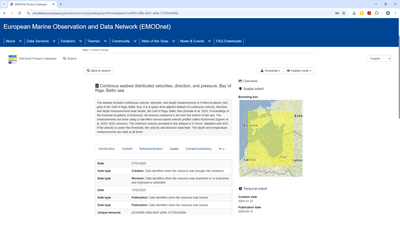
The full dataset is available for download from EMODnet, a detailed article describing the study methodology and findings, is available under Files.
Associated Products
Additional Details
Type: Data Sets
Theme: Environment, Research, Oceanography, Iliad: Pilots
Iliad Project Component
Language(s): English
Contact Information:
Asko Ristolainen
Senior Researcher
Tallinn University of Technology
Screenshots
Feedback
Have you used this product? Please provide feedback to help product owners improve the quality of their products.